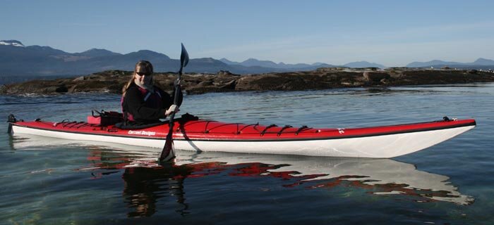
Paddle British Columbia's North Coast
The following is a description of regional overviews drawn from the paddling experiences and personal website of author and Wavelength publisher John Kimantas. Jump to the various regions discussed by clicking on the map. To jump straight to the archive of Wavelength articles on BC's north coast, click here. To find tour operators for this region, click here.
Description:
 The North B.C. coast runs from McInnes Island on the south end of Princess Royal Island to the Alaskan border. It is a nature lover's playground, with common year-round inhabitants including killer, humpback and gray whales. It is isolated, however; road access is
  possible to only Kitimat and Prince Rupert. For all other regions boat or planes are the only way to travel. First Nations communities include Klemtu on the east side of Princess Royal Island, Hartley Bay at the convergence of Douglas Channel and Grenville Channel, Kitkatla on Dolphin Island near Porcher Island southwest of Prince Rupert, Metlakatla near Prince Rupert and Lax Kw'alaams near the Alaskan border.
The most popular way to enjoy the North Coast is via the Inside Passage. The two main channels for this route are Princess Royal Channel and Grenville Channel, with the latter nicknamed 'The Ditch' for its long and straight cut through the mountainous terrain. The Outside Passage, however, offers a scenic and lesser-used alternative with highlights including the Estevan Group - a perfect kayaking destination - and Laredo Sound. There are also numerous island groups to explore to the north of Principe Channel, particularly around Porcher Island.
Highlights:
The Inside Passage is the most travelled route, but there are spectacular alternatives. One rarely visited location is Fiordland Provincial Park. Accessible to the Outside Passage is Laredo Inlet, soon to be protected as the Kitasoo Spirit Bear Sanctuary. It and nearby Gribbell Island are home to the highest concentrations of Spirit (or Kermode) Bears in the world. Other highlights of the Outside Passage are Campania Island and the Estevan Group, south of Banks Island. Both are perfect for exploration by kayak, though remote. Prince Rupert remains a cultural and transportation hub for the north coast, with the nearby islands, particularly Porcher Island, serving as a playground for the adventurous. Off Portland Inlet near the Alaskan border is Khutzeymeteen Grizzly Sanctuary, the only grizzly bear reserve in the country.
Kayaking the Prince Rupert region
Description
 This region is visited only by a few adventurous paddlers each year who stick mainly to areas such as Oval Bay on the northwest side of Porcher Island. Prince Rupert itself has broadened its image from an industrial port city to a more cosmopolitan atmosphere thanks in large part to the new cruise ship terminal, which hosts visiting liners throughout the summer season. It is also a ferry hub for the B.C. Ferries' Inside Passage service and for routes to the Queen Charlotte Islands. Nearby island clusters and a variety of magnificent inlets make this a wonderful place to explore.
Highlights
Porcher Island is the main attraction in this region, with numerous island clusters, beaches and inlets to explore. Nearby Stephens Island offers a more exposed adjunct, while the Dundas Group, in the more remote north, is a draw with numerous areas to explore and wonderful beaches dotting the islands. Portland Inlet, Work Channel and Quottoon Inlet offer some spectacular inland scenery. Khutzeymeteen Inlet ends in the Khutzeymeteen Grizzly Sanctuary. Land-based viewing is prohibited without being accompanied by a licensed guide, but water-based viewing is accepted (though discouraged). If you do wish to see grizzlies, don't despair - there are many places to view them on the coast. Look best grizzly viewing sites listed in The Wild Coast, Volume 2.
The history, ecology, attractions and camping locations for this region can be found in The Wild Coast, Volume 2. The following is an excerpt:
When I first arrived in this region a wind picked up in Kitkiata Channel and I ducked into a beautiful little campsite in the Pelham Islands . This was followed by several leisurely days exploring the beaches outside Porcher and Stephens islands. On the exposed ocean I bobbed on the water outside Fan Point and chatted with two boaters who happened by on skiffs. The odds of a prolonged conversation with passing boats on the open ocean might have seemed slim, but there it was – a perfect day for kayaking.
This was followed by stays at beautiful beaches on tiny isolated island groups like Rachel Islands and Moffatt Islands , a cluster at the Dundas Group. I stopped at the dock at Lax Kw'alaams and had a hamburger at the little restaurant there and chatted with a friendly group of youths diving off the dock on a sunny summer's day. Then it was across Portland Inlet in the early evening in conditions so calm I could hear four separate whale groups surfacing several miles away, clear into Chatham Sound. Several groups would pass close by, including a pod of killer whales.
Beautiful stretches of beach were everywhere here, one of the few places on the coast where the camping opportunities are every bit as beautiful as the surroundings.
There is so much to see and do here it is definitely worth a return trip. For many visitors from Alberta this area is as close as Vancouver . Only a few make the journey, however. During my time here a few kayakers and campers were making use of Oval Bay and the nearby beaches on Porcher Island . A family of boaters was darting around on dinghies, a yacht was anchored in Freeman Passage and a UBC archaeology group was on Dundas Island . Otherwise it was just me and the fishermen who invariably fill the coastal waters. It seemed remarkably underpopulated, but that seems to typify the B.C. coast. - John Kimantas
Kayaking the Northern Channels (Principe and Grenville)
Description
Principe and Grenville channels represent the two northern options for travel by water to Prince Rupert. The most heavily used by far is the Inside Passage via Grenville Channel, which has popular anchorages along its length including Lowe Inlet and Klewnuggit Inlet, to name just two. For kayakers beaches can be found along the length for suitable shelter in most conditions. Rarely used by comparison is Principe Channel. A few adventurous mariners take this route to avoid the heavy traffic in the narrow portions of Grenville Channel, where the commercial traffic, including cruise ships and freighters, can be intimidating. Adding to the appeal of Principe Channel are the various island clusters, especially those around Anger Island. The outer coast of Banks Island is for the most adventurous only. It is a reef-strewn, exposed stretch of water that can be extremely dangerous.
 Highlights
Grenville Channel's beauty makes it worth experiencing, even if it is the busier of the routes. Klewnuggit and Lowe inlets both make for wonderful exploration, as both have trails leading to nearby lakes. Union Passage has its own appeal, if you can time your visit to enter through the sets of narrows. North Banks Island has some beautiful sand beaches, with Deadman Inlet arguably the best among them. The islands around Anger Island will appeal to many explorers, though the scenery can be repetitive.
The complete history, ecology, attractions and camping locations for this region can be found in The Wild Coast, Volume 2. Here is an excerpt:
A wolf stepped onto the rock bluff at Kewar Point in north Principe Channel. Rather than run away, he came down the bluff to get a better look at this strange creature in a kayak.
A few hours later I found myself on a glorious white sand beach on the north end of Banks Island – just the first of many beautiful beaches I would find here.
A few weeks later, paddling down Grenville Channel, I was about to cross from Stuart Anchorage to Kumealon Inlet when a splash caught my eye. I turned and saw a humpback slapping a fin against the water. Seeing he was in a playful mood I decided to take the time and paddle towards him. For my effort I was treated to a great show of splashing and jumping before he finally headed north.
At Lowe Inlet I crossed into the little bay outside of Verney Falls to spy a grizzly taking advantage of the jumping salmon in the holding basin. It was a few moments before the grizzly saw me, roared his disapproval, then disappeared into the forest.
Those are just a few of the memories of this region. There are two ways to see this area: the traditional route of the Inside Passage through Grenville Channel, or Principe Channel, a wider passage with a lower topography but a more convoluted shoreline.
When deciding which way to go, there is no magic answer. Most boaters will probably prefer the established anchorages, carefree route and awe-inspiring mountain scenery of Grenville Channel. Kayakers and adventurous boaters, however, will likely be drawn to the Outside Passage for its intricate island groups and varied shoreline. But just as easily they could explore the various inlets of Grenville Channel and not feel that they've missed a thing.
- John Kimantas
Kayaking the Kitimat region
Description
 The channels around Kitimat have yet to be discovered as a key kayaking destination, even though the area has all the ingredients. The passages are long and sometimes prone to wind, but the attractions are many, including five recently created provincial parks. A huge advantage of this area is that Kitimat is accessible by car, meaning you can launch without the need for a ferry or water taxi. If you love mountain scenery, Kitimat is a great place to explore.
Highlights
The mountain scenery in Verney Passage is stunning - just about the best on the coast. Meanwhile, Gardner Canal extends deep into the mainland to end at Kitlope Heritage Conservancy - a perfect wilderness adventure. Hot springs dot the area, with Weewanie Hot Springs a new provincial park. Both Foch Lagoon and Gilltoyees Inlet, key parts of the new Foch-Gilltoyees Provnicial Park, both make great places to explore. A circular route from Kitimat down Verney Passage to Hartley Bay and back via Douglas Channel is a world-class holiday.
The complete history, ecology, attractions and camping locations for this region can be found in The Wild Coast, Volume 2, Chapter 7. The following is an excerpt:
When I showed up at Moon Bay Marina in Kitimat 38 days into a kayaking trip, I was somewhat of an oddity – not just because I was just coming out of 13 days of rain in a row and looked the part, but because I was on a kayak.
Two days later I was sitting at the marina's deck with owner Don Pearson. As we chatted recreational fishing boaters came and went, but no kayaks. Don told me there was once a place in town that rented kayaks, but that was a few years ago. There were no tours based out of Kitimat and just as few visitors planning their own tours. Other than a few kayaking enthusiasts in town, fishermen owned the nearby channels.
Somehow Kitimat and its various nearby waterways have missed the kayaking radar. Maybe it's because Kitimat has a reputation as an industrial town. Maybe it's the distance, even though a ferry trip isn't needed.
Maybe it's because the word simply isn't out yet. But when it does leak, Kitimat will undoubtedly evolve into a world-class kayaking destination. It has some of the best mountain scenery on the B.C. coast. It has the highest concentration anywhere of kermode bears (south Gribbell Island ). And a string of hot springs are just a day's paddle apart, making it possibly the only place on earth where you can end an agenda three days in a row by paddling up to a hot spring.
It's also one of the few car-accessible locations on the B.C. coast, meaning you can drive here and launch without being held up by a ferry schedule.
In all it makes for one of the most appealing destinations on the coast, with the added advantage that it has yet to be discovered – though I suspect in a few years the fishermen of Kitimat will be wondering where all the kayaks suddenly came from.
Kayaking "Spirit Bear" (Laredo Sound)
Description
This area is one of the more remote on the B.C. coast, far from any community. Naturally, the rewards are great for those who take the time to venture here. Campania Island has my vote as my favourite island on the B.C. coast. Most visitors will stop at Laredo Inlet, soon to be part of the Kitasoo Spirit Bear Protected Area. This scenic location is convenient to Klemtu, and is notable for the high concentration of Kermode or white Spirit Bears that inhabit Princess Royal Island. This is also fishing country, with numerous lodges dotting Fin Island, Barnard Harbour and Aristazabal Island.
 Highlights
Campania Island is my recommended destination for its impressive mountains and its sand beaches. For kayakers, the nearby Estevan Group with its numerous channels makes a great place to explore. Surf Inlet is long but scenic with ruins of an old mining operation to explore at its head. Laredo Inlet is a popular destination, and numerous island groups at its mouth make for wonderful kayaking. Laredo Channel also has its own selection of beaches and a number of inlets to explore, while north and west of Aristazabal Island are more island clusters, many protected as ecological reserves (which are consequently off-limits to the public).
The complete history, ecology, attractions and camping locations for this region can be found in The Wild Coast, Volume 2. Here is an excerpt:
Commercial and industrial traffic will probably always favour the Inside Passage through Princess Royal Channel, but an increasing number of recreational boaters are taking the alternative route through Laredo Channel. A small number of kayakers have discovered Laredo Sound , Campania Island and the Estevan Group as some of the most rewarding kayaking destinations on the coast.
One popular route begins at Klemtu and follows Meyers Passage to explore Laredo Inlet, which is newly protected by the Kitasoo Spirit Bear designated area. It is a fairly sheltered location with camping opportunities spread about the various islets and on sandy spots at Kitasu Bay .
From there the options on where to travel depend on how far and how remote you want to travel. And it doesn't get more remote than many of the outlying island groups, which sit as far as 11 miles/17 km from the outer edge of Aristazabul Island . Three clusters of the most far-flung outlying islands are protected as ecological reserves. This keeps most of these islands off-limits to visitors – not that they see too many anyway.
Campania Island is my favourite island on the B.C. coast. Its striking mountain range, its sparsely forested slopes, its potential for hiking, its superb beaches, its convoluted and interesting shoreline – it is simply an exceptional place to explore.
If you visit Campania , the Estevan Group is a natural adjunct. It is a complex maze of islands and passages worthy of at least a day or two in a tour of this area. It is a mix of serene passages and as rugged an outer shoreline as any.
Gil Island and its waterways are most famous as fishing destinations. Those who venture slightly south will discover the beauty of Emily Carr Inlet and Surf Inlet, a passage that cuts deep into Princess Royal Island.
- John Kimantas
Kayaking Fiordland
Description
Fiordland is the name for the provincial park set deep in the inner channels northeast of Klemtu. It is convenient to the Inside Passage, and yet rarely visited, despite some of the most impressive scenery on the coast. Most travel Finlayson Channel and/or Tolmie Channel north through the Inside Passage, often via Mathieson Channel to Jackson Passage for a scenic diversion. A small provincial park at Jackson Narrows is just one of a number in this region that protect anchorages. Green Inlet Marine Park and Oliver Cove Marine Park are others.The native community of Klemtu is a place to get water, gas and supplies as well as some welcoming native hospitality. The community offers a number of tourist services including guided heritage and scenic tours, cabin rentals in traditional territories and kayak rentals as well as a water taxi service. Meyers Passage and Higgins Passage lead to Laredo Channel. A smattering of beaches make even the longest and steepest of channels options for travel by kayak.
 Highlights: Kynoch Inlet is one of the most scenic locations on the B.C. coast. The century-old wreck of the Ohio in Carter Bay is worth a visit. Nice beaches dot the region, including some particularly nice spots near Lady Douglas Island. Higgins Passage is an intricate waterway with traditional First Nations sites amidst a multitude of maze-like islands and twisting passageways. Be sure to keep your eyes open for the Watchman Pole.
The complete history, ecology, attractions and camping locations for this region can be found in The Wild Coast, Volume 2, Chapter 5. Here is an excerpt:
My introduction to Fiordland came through a few pages in an old marine park guide. The landscape pictured was stunning, and it became a goal of mine to paddle this area one day. But there was the nagging doubt – fjords are steep and inhospitable. Would it be possible?
I had visions of having to spend a night hunkered down in the cockpit of my kayak – a better choice than sleeping in an estuary home to numerous grizzlies. Facing the prospect of traveling long, steep channels I thought I might even have to hitch a ride on a passing yacht.
In the end my fears were unfounded, and Fiordland makes a wonderful place to explore by both boat and kayak. While camping locations are rare, they do exist, and the scenery is definitely among the most spectacular in the world.
Most visitors tend to pass up the opportunity to visit Fiordland and instead stick to Finlayson Channel, heading as fast as possible into Princess Royal Channel. This isn't necessarily a bad thing. Princess Royal Channel is without doubt one of the most beautiful areas of the coast, with impressive mountain scenery, breathtaking waterfalls and even the old ruins of Butedale to explore.
Historic Klemtu, the last Kitasoo/Xai'xais community on the coast, serves as a transportation hub for this stretch of coast. It also has an active tourism program with guided tours leading into areas not easily explored and to cultural attractions easily overlooked.
Outside of Klemtu, though, the rest is essentially wilderness. Most other human influences are slowly being reclaimed by the forest, whether it is the skeleton of a century-old beached hull or a decaying mill. Long and steep waterfall-filled passages and glacier-chiseled mountains are the only lasting attractions in this part of the world.
- John Kimantas
Archived North Coast articles:
|
|
Where bears still rule: the Great Bear RainforestFour dominant things tend to unite this vast area of land: trees, water, mountains and bears. Take your pick of any of a thousand lesser but equally vital pieces of the puzzle (let’s not forget salmon), but among mammals certainly, nothing exemplifies this wilderness area quite like the bear. |

|
|
Coasting through KitimatUnassuming Ucluelet offers a unique glimpse of life on the edge. |

 |
New Vistas - Wavelength looks at some of BC's least visited but most enticing kayak destinations, starting with little-known Fiordlands / Summer 09 |
-
Loafer’s Log - by Ron Mumford Winter 2008
-
From the Rainforest: Great Bear Rainforest - by Dan Lewis Fall 2007
-
Explorers and Voyageurs by Gordon Baron and Cindy Phillips Spring 2007
-
My Personal Challenge Story and photos by Hayley Shephard February/March 2006
-
Exploring Rivers Inlet Story and photos by Gordon Baron June/July 2004
-
The Future of Bute Inlet by Eric Blueschke February/March 2004
-
The Reluctant Kayaker: Up the Inside Passage by Marika Wilson August/September 2003
-
My Secret Inlet by Trish Smyth June/July 2003
-
Central Coast Paradise by Gordon Baron June/July 2003
-
Maple Leaf Adventures by Alan Wilson June/July 2003
-
From the Great Bear Rainforest by Evan Loveless February/March 2003
-
Accessing the Central Coast Pictoral June/July 2002
-
The Forgotten Coast by Evan Loveless August/September 2001
-
The Legend of Skookumchuck by Stuart Smith June/July 2001
-
Reflections on the El Niña Expedition by Alice Weber June/July 2000
-
Princess Royal Island - The Epitome of Perfection by Stephanie McCune June/July 2000
-
Mothership Kayaking the Inside Passage by Jennifer McMahon April/May 2000
-
Past Rhythms-Future Visions Bella Bella BC, by Alan Wilson February/March 2000
-
The Land Of Plenty - Mound Island, Broughton Archipelago by Tim Shiff February/March 2000
-
Carvers of Fort Rupert and other First Nations galleries by Rajé Harwood February/March 2000
-
Around the Cape: A Guide's Getaway - Cape St. James BC - February/March 1999
-
Sailing the Forgotten Coast: The Outside Passage BC - February/March 1999
-
Best of Both Worlds - Mothership Kayaking April/May 1998
-
Central Coast Exploration - Mothership Kayaking April/May 1998
-
Light on the Ocean - Mothership Kayaking April/May 1998
-
Discovering the Mid-Coast by Deb Leach October/November 1996
-
Through Higgins Passage by Howard Stiff October/November 1996
-
Exploring the Kitasoo Coastline by Howard Stiff August/September 1996
-
Getting to Know the Mid-Coast -- communities of the Discovery Passage route - June/July 1996
-
Kayaking the Mid-Coast -- tips and precautions, by Chris Ladner and Carol Ranger - June/July 1996
-
Princess Royal Island -- Kermode bear country, by Steve Weir - June/July 1996
-
Cape Caution, by Markus Kellerhals - June/July 1996
-
New Mid-Coast BC Ferry - June/July 1996
-
Splendour & Solitude -- Dall Island Solo, by Lilian Alessa February/March 1996
Queen Charlottes
|
|
The land of totemsUnassuming Ucluelet offers a unique glimpse of life on the edge. |

 |
Wind and Wonder - Exploration of Queen Charlotte Islands is at first intimidating, then enchanting - once the wind calms down. By Sheila Porteous. |
-
Gwaii Haanas, a Place of Living Culture February/March 2003
-
Exploring Haida Gwaii by Neil Frazer June/July 2002
-
Visiting Haida Gwaii (Queen Charlotte Islands) by Mary Kellie February/March 2000
-
Paddling Graham Island by Markus Kellerhals August/September 1996


 This site uses valid HTML, CSS and Flash. All content Copyright © 2010 Wild Coast Publishing.