Explorers and Voyageurs
Spring 2007
This is an article from WaveLength Magazine, available in print in North America and globally on the web.
To download a pdf copy of the magazine click here: > DOWNLOAD
by Gordon Baron and Cindy Phillips
Connected by road to the rest of the province, Bella Coola is the third outlet to the Pacific Ocean from the mainland of British Columbia. The village sits in a land of towering mountains, hanging glaciers, turquoise waters, lush temperate old growth rainforest, natural mineral hot springs and legendary explorer routes. This stunning backdrop of coastal scenery is a voyager’s paradise.
BC Ferries Corporation has opened up this pristine wilderness to the traveling public, connecting Northern Vancouver Island to the mainland using the inside passage on BC’s Central Coast. The motor vessel Queen of Chilliwack will drop you off and pick you up at the remote communities of Port Hardy, Bella Bella, Klemtu, Ocean Falls and Bella Coola, or wet launch you at points in between. The vessel Nimpkish runs between Bella Coola, Bella Bella and Ocean Falls through the summer and into the fall. These connecting links have made easy access for paddlers to explore the untamed natural beauty of the remote Central Coast.
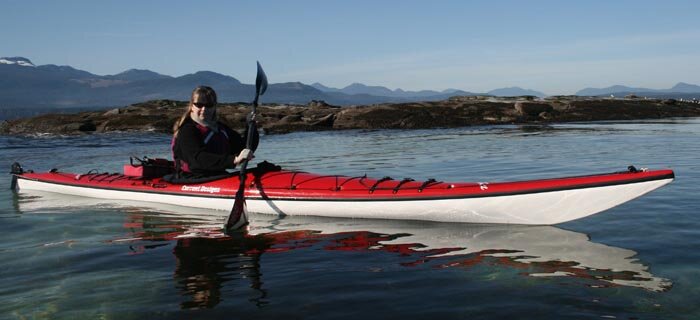
Bella Coola is located 450 km north of Vancouver at the head of North Bentinck Arm. Be prepared before you arrive—the closest kayak supply centers are Red Shreds in Williams Lake (456 km inland to the east) and Odyssey Kayaking in Port Hardy (250 km by water to the south). Whether you are a beginner or advanced paddler, you can challenge your limits for adventure.
Bella Coola is home to the First Nation Nuxalk people. Archaeological studies at Thorsen Creek date their ancestral heritage back 10,000 years. The people who lived in this village were a fishing, hunting and gathering society. Salmon and eulachon (candle fish) were their traditional food source. More than 45 Nuxalk villages were scattered along the Bella Coola River, South and North Bentinck Arms, Burke and Dean Channels.
Eulachon were trapped or netted, placed in wooden “stink boxes” and left to ferment for seven to ten days, and then cooked. In the boiling process, the fish oil rose to the surface, which was then skimmed and cooled, turning the oil into an off-white grease. This was used to accent the flavor of food, in a similar way to how we now use butter. The grease was stored in cedar boxes which when full, weighed more than 100 lbs. The grease was used for trade with interior First Nation villages. Women and men carried these boxes on their backs along the intricate network of trail systems leading to the interior plateau of the Chilcotin. The route was known as the “Grease Trail.” Part of this land and sea route was later renamed the “Alexander Mackenzie Heritage Trail.”
The last big run of eulachon was in 1998. Since then they have virtually disappeared from the river, ending a Nuxalk tradition that lasted many generations. The Nuxalk have had some success in raising eulachon and releasing them back into the river systems.
In the summer of 1793, explorer Captain George Vancouver and his crews mapped the coastal inland waterways of the inside passage of British Columbia on the vessels Chatham and Discovery. In the same year, fur trader Alexander Mackenzie and his voyageurs finished their historic crossing of the North American continent at Bella Coola and Dean Channel. These two expeditions missed each other by just weeks at the head end of North Bentinck Arm. These explorers opened up uncharted land and sea routes to Canada and the rest of the world.
Sir Alexander Mackenzie is considered one of the greatest of all North American travelers. Two hundred and fourteen years ago, Mackenzie and his crew found a fur trading route from Fort Chipewyan on Lake Athabasca to the Pacific Ocean. They paddled the Fraser River, crossed the interior plains of the Chilcotin Plateau using Carrier and Nuxalk guides, and traveled down the Bella Coola River. This journey was the first recorded 6,400 km crossing of the North American continent.
From Bella Coola, they paddled another 60 km to the entrance of Elcho Harbour in Dean Channel to make sure they had reached the Pacific. At this location, on a rock face, Mackenzie mixed vermilion and grease and inscribed “Alexander Mackenzie from Canada by land 22nd July 1793.” Later, this inscription was carved in stone and a monument built to honor this historic event.
In the fall of 1894, Norwegian settlers from Minnesota landed on the north shore of the Bella Coola estuary. Each settler received a grant from the government of 160 acres to clear and develop their land. This community settled in the area that is now known as Hagensborg. The fjords and landscape reminded them of their homeland in Norway.
The transition zone at the headwaters of North Bentinck Arm is one of the richest, most diverse and productive ecosystems on the mid-coast. The mud and sand flats act as buffers against the storm surges, providing nesting habitats for thousands of migratory and resident birds, and a sheltered entrance for the spawning salmon into the Bella Coola River systems.
Just about everything that has ever happened in human history in Bella Coola relates to the estuary. Evidence of this is everywhere. Paddling to the north shore, you can see the ruins of a mile long pier that was built in the early 1900s. Coastal steamers unloaded supplies and people for the townsite that once stood near the Necleetsconnay River. Following the narrow and shallow passageways on the south side of the estuary, you come to the ruins of commercial fish boats still in their boathouses. Paddling up the lower Bella Coola River from the head end of North Bentinck Arm, we have seen the old wooden stink boxes, smokehouses and dugouts once used for the eulachon and salmon runs. Drifting down the river to the Pacific Ocean, we felt like a part of Canada’s history, experiencing what Alexander Mackenzie and his voyageurs did more than two centuries ago.
Coming into view from the river mouth on the south side of North Bentinck Arm is the old BC Packers Clover Leaf Cannery, established in 1900. Canning stopped in 1935, but it is still used by the Nuxalk to mend and store nets. A few years ago we met two elders mending nets in the cannery. Annie Schooner and Mercy Snow worked in the canneries years ago. Mercy was born at Tallheo Cannery during the summer fishing season. When fishing started, the whole family moved to the canneries. Unfortunately, Annie and Mercy no longer mend nets at the cannery, but I will always remember how excited they were, talking about their cannery days and how their stories captivated audiences for hours.
Across the inlet is the picturesque Tallheo Cannery, built in 1917. This is the prettiest natural setting for a cannery on BC’s coast. In 1996, Tallheo Cannery was transformed into a fresh seafood restaurant and inn just in time for the Queen of Chilliwack’s maiden voyage on the “Discovery Coast Passage” route.
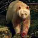
Custom Point on the west side of Tallheo was the check in point for foreign adventurers to the Caribou gold fields in the later 1800s. Sixteen kilometres to the west is Green Bay. In the summer of 1794, after fighting inflow winds, Alexander Mackenzie stopped and camped here. Mackenzie named this bay “Porcupine Cove.” In the 1920s, this area was a camp for a railroad logging operation. You can still see the railway trestle extending out over the bay. Up valley there is supposed to be an old round house that was once used to turn steam locomotives around. A word of caution—hiking up the old railroad line next to the estuary, you will be following the footsteps of grizzlies.
West of Green Bay there is a water line stretching north to south across the inlet. This is where the glacier waters of North Bentinck Arm meet South Bentinck Arm and the inflow currents of Burke and Labouchere Channels.
In summer, heating of air in the interior of the Chilcotin creates suction, forcing a sea breeze from the open ocean inland, through steep mountain fjords of Burke, Dean and Labouchere Channels, and South and North Bentinck Arms, and funneling the winds in a number of directions. Where Burke and Labouchere Channels meet, there is a point of land known as Mesachie Nose, a Nuxalk word meaning “Dancing Waters.” Southwest and southeast winds strike the cliffs and the waves rebound, causing a rough chop. Combined with a large ebb tide, these conditions can cause trouble for paddlers. Following the water line south across the inlet to Tallheo Point, you come to the entrance to South Bentinck Arm. This 25 km inlet is popular with visitors.
Sixteen kilometres down South Bentinck on the west side of the inlet, you come to Tallheo Hot Springs. This picturesque natural setting is located two metres above the high tide mark.The odorless mineral pool is an ideal temperature to soak tired muscles after a day of paddling.
Looking east across the inlet from Tallheo Hot Springs is Bensins Island. Behind the island to the south, you come to Larso Bay. This was the site of an abandoned logging camp, known to the locals as Camp Two Bay. Walking up the old logging road for about a kilometre you come to the trail to heritage cedar tree. This Western Red Cedar is five metres across and more than 1,500 years old. This tree is registered in Victoria as a standing monument to BC’s ancient rainforest.
Traveling north into Labouchere to Dean Channel, the mountains get steeper and the winds get stronger. To venture into this remote, secluded area by kayak, you will need lots of time and have good paddling skills. It is where we used support boats. The abandoned town of Ocean Falls, Jump across Creek, Dean River, Kimsquit, Nascall and Eucott Bay Hot Springs, and the maze of islands and beaches around Bella Bella are great distances apart and take many weeks to explore.


 This site uses valid HTML, CSS and Flash. All content Copyright © 2010 Wild Coast Publishing.