
The West Coast Vancouver Island North BC Marine Trail section:
Leg one, the North Island
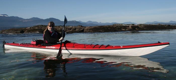
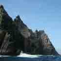
Welcome to the end of the world. Officially it’s only the northern end of Vancouver Island, but when you paddle west past Cape Sutil, the northernmost point on Vancouver Island, you pass a magical point where civilization has tried to encroach, but nature continually reclaims. Many ruins are testimony to nature’s dominance here, which you can feel like the morning mist.
The majority of the coast in this region is within Cape Scott Provincial Park. While the West Coast Vancouver Island North Marine Trail will formalize marine access, foot access went through a similar unveiling in 2008 when the long-awaited North Coast Trail was officially opened. The extension of the Cape Scott Trail allows hiking over the entire north end of Vancouver Island from Shushartie Bay to the old Cape Scott Trail trailhead at San Josef Bay. This opened foot access to vast stretches such as Shuttleworth Bight and Cape Sutil previously limited to access by kayaks and small boats. But don’t worry about overcrowding. There’s more than enough beach for everyone, and this area has some great stretches of sand – an unexpected amount, actually, given the fact this area has a reputation for a rocky, storm-ridden coast.
Crossing Cape Scott by paddle is an exercise in bravery, planning and discretion, with (knock on wood) some luck thrown in for good measure. If all goes well you gain the privilege of being among the few who have successfully transited one of the most notoriously tricky points on the British Columbia coast. South of Cape Scott can be equally problematic. Troubling southerly winds, storms and numerous offshore rocks can make this relatively short stretch of water daunting. But as in all things coastal, timed right you are likely to find yourself immersed in a world populated not by stormy seas but by sea lions, sea otters, grey whales and humpbacks.
A new circuit growing more popular is a circle route from Port Hardy and around North Vancouver Island and back through Quatsino Sound. By making arrangements with tour operators in Port Hardy you can be picked up in Coal Harbour and returned to your vehicle – a convenient ending to a great adventure.
Trail Guide Preview: the North Island
The North Island isn’t just one adventure opportunity. It’s a dozen. Take your pick from idyllic island clusters near launches and pavement to remote and rarely visited beaches. Just be sure to match your skill level to your intentions.
Access Points: If you follow the Island Highway north of Victoria you’ll run out of blacktop at Port Hardy, about 500 km north (308 miles). This is the logical starting point for most North Island adventures, though if you turn west just before Port Hardy’s downtown you’ll follow a rough logging road for 60 km that ends at San Josef Bay and the Cape Scott Trail trailhead. A Western Forest Product campsite offers a boat ramp into the San Josef River, best navigated at high tide. Other options exist within Quatsino Sound at places like Coal Harbour and Port Alice, though they are less convenient to the best kayaking locations of the outer coast. Winter Harbour offers fairly quick access to great paddling at the expense of a rough logging road. Bring a spare, or better yet, two.
Short trip options: Good day paddle and weekend trips out of Port Hardy include all the nearby islands, which are numerous. The most accessible are in Beaver Harbour just east of Hardy Bay. God’s Pocket Provincial Park offers weekend adventures or longer trips spent exploring nearby islands, with the caveat that winds, tides and traffic are high here, particularly in Goletas Channel, which must be crossed. Other destinations in Quatsino Sound offer sheltered paddling, such as idyllic Varney Bay and the mouth of Marble River. Winter Harbour is an ideal gateway for terrific scenery in Quatsino Entrance. Should you find it daunting you can always stay away from open water and explore Ahwhichaolta Inlet instead.
Moderate trip options: Several weeks can be spent exploring the God’s Pocket area, with side trips to the Deserters/Walker Groups and the two larger islands off Port Hardy: Nigei and Hope islands. Going as far as Jepther Point or, with the necessary expertise, Cape Sutil, is recommended. Or by launching from San Josef you can reach Guise Bay and other nearby attractions, including Cape Scott (should conditions allow; if not, San Josef Bay has lots to offer, with beautiful beaches, sea caves, sea stacks and even a trail to the top of Mount St. Patrick for panoramic views of the area). From Winter Harbour trips to Kwakiutl Point are highly rewarding (see the next leg for details of that area).
Advanced trips: The waters in this area tend to be among the most advanced anywhere, with difficulties such as Nahwitti Bar and Cape Scott awaiting any run of this region. Either despite these features or because of them, a circle route growing in popularity is from Port Hardy around Cape Scott into Quatsino Sound to exit at Coal Harbour. The advantage is a very short return trip back to your vehicle at Port Hardy. Plan two weeks allowing for foul weather days at key crossings; any leftover time can be spent exploring the myriad attractions of Quatsino Entrance before the run back to Coal Harbour. Due to prevailing weather an anti-clockwise run is best. If transportation logistics allow it, variations can include ending at San Josef, Winter Harbour or continuing down the coast for a partial or complete run of the whole trail. (A solution in these situations is two vehicles for the group, with one parked at each trailhead. Otherwise options such as the shuttle bus to the Cape Scott trailhead may suit. Local operators may also have solutions – contact the tour operators and water taxi services listed starting page 34.)
New BC Marine Trail sites: Veterans of this area may be disappointed to see few if any unknown sites added to the inventory, and quite a few missing. But there is progress. Sites on Vancouver Island at Songhees Creek and a sheltered cove dubbed Goodnuff Beach are now official sites, as well as Nolan Point and the booms across Goletas Channel on Balaklava Island. Not much can change along the north shore, as it is already within Cape Scott Provincial Park, but all established sites at places like Nissen Bight, Nels Bight and Cape Sutil can now be considered marine trail sites as well.
Quatsino Entrance is the biggest benefactor of new sites in this region, with established places like Raft Cove and Hunt Islets getting the tentative nod, while new sites have been inventoried near Rowley Reefs and the north entrance (with a brilliant new find at a place dubbed Quatsino Caves Beach, where the sea caves make great exploring).
Only about half the sites in this region are listed. The remainder have yet to be given the official okay.
John Kimantas is editor of Coast&Kayak Magazine.


 This site uses valid HTML, CSS and Flash. All content Copyright © 2010 Wild Coast Publishing.
Coast&Kayak Magazine is providing this forum beginning with this issue to offer feedback on our content. We screen submissions prior to posting, so there may be a lag before seeing your feedback online. Please note it's our intention to print the best of the replies we receive, so please leave a valid email for verification purposes. Email addresses will not be printed.