
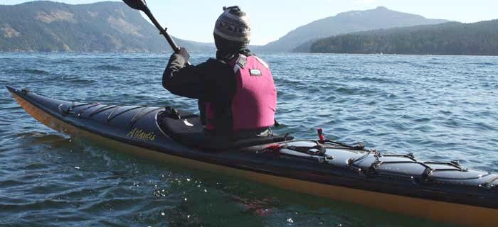

The West Coast Vancouver Island North BC Marine Trail section:
Leg two: Brooks/Kyuquot
The tufted puffins won me over, but it was the humpback that made the greatest impression.
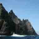
During my first pass through this area back in 2003 I left Klaskish Inlet well before dawn to make good time around Brooks Peninsula while I had a favorable weather forecast in advance of a storm. It was dead calm as the sun rose, and the only sound for hours was the splish of my paddle and thousands of tiny jumping fish that kept me company. The fish may have been a warning of what was to come, because in what seemed a monstrous parody a humpback whale breached the water in front of me, close enough so I could see the individual ventral grooves, and crashed down in an explosive landing.
This was the start of a parade of wildlife that day. The stars were the hundreds of colorful tufted puffins flying past in businesslike fashion, then crash-landing in an ungainly ball of sprayed water. Eight years later, I still rank this as my single best day of kayaking. At one point two grey whales surfaced in front of me, side by side, so close to my kayak I couldn’t have fit my fingers between the closest and my kayak. There they were, two whales stacked together in front of my kayak. If only my film camera hadn’t run out!
Brooks Peninsula may seem a distant and imposing stretch of land, and indeed it does have a well-earned reputation as a stormy and dangerous location (the last kayaking fatality was in 2008, while five fishermen were lost in Side Bay in 2010). But access to both the north and south sides of the peninsula mean the best features can be enjoyed without the danger of a full-fledged crossing. Popular kayaking destinations are the Mission Group Islands near the entrance to Kyuquot Sound to the south, or the Bunsby Islands which lie closer to Brooks Peninsula. Both are notably excluded from the current list of marine trail sites – the Bunsby Islands due to the ecological status of the archipelago’s foreshore, which precludes public access (an oddity that has been ignored by both visitors and reserve officials for decades).
Another world awaits exploration to the north of the peninsula. Arriving here from Quatsino Sound means passing the rugged and exposed shores of Lawn Point Provincial Park, which offers several inviting camping options as well as fantastic reef-strewn shores. Inside Side Bay are more island clusters, beaches and inlets to be explored. A trip to Solander Island, a major seabird sanctuary, is recommended if conditions allow. Don’t worry, you won’t bother the seabirds. The island is surrounded by inaccessible cliffs.
Several spectacular beaches are located near Jackobson Point. Long established as campsites, they run the same difficulty as the Bunsbys in that the foreshore is within the Checleset Bay Ecological Reserve. So they’re off the marine trail list and within that grey area that is a bit of a parody of the no-trace camping slogan: sneak in, sneak out.
That and First Nations considerations have kept most of the stretch between south Brooks Peninsula and Kyuquot Sound unmarked for designated marine trail sites. While recreational use is likely to continue to be enjoyed, official designation is still a question mark and a major quandary for marine trail proponents.
Trail guide preview: Brooks/Kyuquot
While seemingly too wild and inaccessible for a casual visit, many kayakers enjoy serene visits by taking a water taxi. This, for instance, cuts down the length of the trip from the launch site at Fair Harbour or Artlish River, which would otherwise require one day out and one day back by paddle. Add another day of paddling each way if your goal is the Bunsby Islands.
Water taxis are harder to come by if your goal is the north end of Brooks Peninsula. Luckily water access is a bit simpler as paddling to some key locations will take a few hours, not days.
Access Points: For south Brooks Peninsula, two key access points exist in Kyuquot Sound. Both are within the auspices of the Kyuquot/Checleset as a result of the Maa-nulth Treaty. Public access remains unchanged, however.
For visitors to the north side of Brooks Peninsula, two points provide handy access to the water, though transit requires a lengthy drive over tough and active logging roads. Expect white knuckles. Side Bay provides the most direct access, with the advantage of being on an extremely scenic beach, while Klaskino Inlet has a small and very rough boat launch with limited parking.
It is also possible to reach the Side Bay area from the Quatsino Sound launches such as Winter Harbour.
Short or moderate trip options: Almost any trip here should involve several days, but it is worth the investment. While water taxis will cut the travel time to your base camp, a week is still recommended and you won’t regret the time. For self-directed trips, a launch from Fair Harbour makes Rugged Point a great and easy destination, with the Mission Group a slightly more advanced option.
To the north, both Side Bay and Klaskino Inlet make Heater Point a wonderful destination, or any of the other campsite options from Lawn Point to Apple Islets. Weather permitting a day trip to Solander Island is exceptional.
Advanced trip options: The prize, of course, is a transit of Brooks Peninsula, usually run from north to south to take advantage of good weather (that being the prevailing northwesterly).
New BC Marine Trail sites: This region is problematic as the foreshore along the south peninsula including the Bunsby Islands is in Checleset Ecological Reserve. Because of this the foreshore is barred from public access (the islands themselves are not). The ecological reserve was created in 1981 to protect sea otters that were reintroduced here. They are now flourishing, but the current strategy remains to direct recreational use away from the islands towards Big Bunsby Provincial Park, which was created to serve the recreational needs. Unfortunately, camping is at a premium on the island, and the two inventoried sites surveyed by the BC Marine Trails Network Association are less than ideal. Also off the list are many Mission Group sites (with the notable exception of South Spring Island, which remains outside the Maa-nulth Treaty lands). In other words, this area still has much to be done.


 This site uses valid HTML, CSS and Flash. All content Copyright © 2010 Wild Coast Publishing.
Coast&Kayak Magazine is providing this forum beginning with this issue to offer feedback on our content. We screen submissions prior to posting, so there may be a lag before seeing your feedback online. Please note it's our intention to print the best of the replies we receive, so please leave a valid email for verification purposes. Email addresses will not be printed.